Sunday, November 22, 2015

The Tyndrum Hills: Beinn Laoigh [Ben Lui] (28) and Beinn a' Chleibh (281)

Walk date: 11/07/15
My Munro #'s: 274 and 275

Pronunciations - translations - heights:

Byn a chlayv - hill of the chest - 916m
Byn loo-ee - hill of the calf - 1130m

Statistics:
Duration - didn't record, relatively short!
Distance -  13.3km
Total ascent -  1170m
Weather - a little drizzle and windy on tops but much better than yesterday!
Team - Paul P
Other hikers: none


Hike week 2015 - Day 8 - Saturday

This hike started with a fairly wide but shallow river crossing and a rather low railway bridge to crawl under while standing in a tributary to the river.  All very odd!  Once across and into the forest a winding path goes gradually upward getting boggier and boggier as it goes.  It even got to the stage of socks being soaked with bog water and having to grip spiky pine branches and use them to swing around the worst bits with only partial success.

Once you survive the forest and its bogs we made our way along the upper glen, opting to aim for the col rather than do the circular as plotted as we certainly wouldn't lose any views on this day!  There was a path and we even saw it at stages, but the ground was so open and wet that it makes little difference until the final climb is reached.  

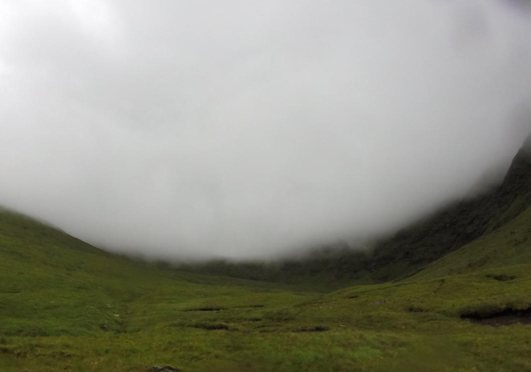
Once at the col we decided to do the shorter Beinn a' Chleibh first and leave the highest peak of the week, Ben Lui, for a finisher.  Beinn a' Chleibh was quite grassy and came soon enough with the extra height of Lui meaning venturing into a rocky terrain for that hill.  I would talk about the amazing views but as you can see from the photos, we didn't see much other than the ground.

A point of interest for this hike was that I left my GPS on top of the car as we drove away from the car park!  We noticed it dropping off and so went back for it - only to find that a kindly gent had stopped and picked it up for us only then to miss us turning around - the kindly gent had only stopped there to help with a car that had just moments before left the hill and rolled down an embankment!  It was all happening at Tyndrum!  Anyway, due to having my address in the GPS the kindly gent posted it back to me the next week, and interestingly enough the GPS had continued plotting its progress from the hike all the way to the gent's house in Glasgow!

That's it for this year then.  See you in 2016 for the grand finish - 7 to go!


Views go downhill from here!  Pardon the pun!


The lower slopes of Lui:

Looking down the glen from the col:

Rocky terrain on Lui:

Last Munro of the week!


Homeward bound...


Labels: , , , , , ,

Saturday, November 21, 2015

The Cruachan Hills: Beinn a' Chochill (172) and Beinn Eunaich (156)

Walk date: 10/07/15
My Munro #'s: 272 and 273

Pronunciations - translations - heights:

Byn a' cho-chil - hill of the hood - 980m
Byn ayneech - fowling hill - 989m

Statistics:
Duration - 09:10 - 15:20
Distance -  18km
Total ascent -  1250m
Weather - dull from the start, then so wet and windy for Beinn Eunaich that turning back was seriously considered!!
Team - Paul P
Other hikers: none - just the farmer!


Hike week 2015 - Day 7 - Friday

On a good day these hills probably provide a nice jaunt out, having good fast access via farm tracks and not being too airy or rocky.  Today these features meant the hills were merely passable and even that was at a push for Beinn Eunaich!

With the cloud as low as it was we knew we weren't in for views but we were still up for it especially given the speed that the farm tracks afford you.  

Beinn a' Chochuill comes easy enough after leaving the farm tracks, although the initial ascent is not to be sniffed at.  The route onward to Beinn Eunaich is mostly grassy easy walking, but today that just meant quite exposed, although not as exposed as when we started to climb onto the rocky top of Beinn Eunaich.  By this stage the very wet weather was accompanied by very strong wind, and we got to the stage that if we hadn't been so damn close (last 100m) that we'd have turned around.  I remember vividly a nice natural nook in the rock that we used like troops under fire for a quick status report before making a run for it to the next shelter!  Phew, we just about made it!

With the weather as it was I had us start the descent early (red line on plot) over safe grassy slopes.  There was no path and it was very boggy, but I knew that with every metre down the weather would be getting better and it certainly paid off that way.

Battered but happy we paced it down the tracks again only to be met by the farmer who seemed quite baffled that anyone had gone up on this day.  Ironically, this night saw us go to our luxury night in the Bridge of Orchy Hotel who of course did not have a drying room!  Come back Glencoe Hostel - all if forgiven!!!


A long good farm track took us quickly up into the cloud:

Here we are!

The incline lessens as we near the top of Beinn a' Chochill:

Beautiful scenery on Beinn a' Chochill:

Bad, bad conditions on Beinn Eunaich means that this is our best shot!

Retreating back to the grassy ridge between the two:

Ironically, after our wettest day we had our 'luxury' night, which had no drying room!

Labels: , , , , ,

Friday, November 13, 2015

Glen Etive: Stob a' Choire Odhair (226) and Stob Ghabhar (55)

Walk date: 08/07/15
My Munro #'s: 268 and 269

Pronunciations - translations - heights:

Stob a kora ooer - peak of the goat - 945m
Stop gower - peak of the dun coloured corrie - 1090m

Statistics:
Duration - 09:10 - 15:20
Distance -  18km
Total ascent -  1250m
Weather - grey start turned very wet for us on the first hill only to come quite nice on the second and a decent end.
Team - Paul P
Other hikers: 3 normal and 2 hill runners!


Hike week 2015 - Day 5 - Wednesday

This hike has a nice start on part of the West Highland Way and then a good estate track which heads west until the University of Glasgow club hut signals the start of the path up onto the hills.  This path is boggy at first but improves as height is gained.

The path onto Stob a' Choire Odhair is an obvious departure from the path up the glen after the hill's first flank is rounded, and progress remains good. despite the increased incline  Unfortunately for us this is where the clouds sunk around us and the heavens opened up.  I made a quick (correct!) decision to commit to my waterproof trousers and the rest of this hill was then a foggy and cold confusion until we found the descent route whereupon the weather thankfully broke and the sun even made an appearance - clearly the weather looked more kindly on Stob Ghabhar today!  That was a positive as comparing the two as we continued clearly showed Stob Ghabhar as the hill with the greater character.

The back of Stob Ghabhar has some great scrambly character with some steep sections and then a fine rocky but easy ridge sweeping to the summit, still with some snow lying.  At this point we were feeling pretty great until at the last moment we were pipped to the top by the strange breed of the fell runner!

Our descent was a fine stroll with just a bit of rough grassy randomness before finding a path again and making the quick crossing back across Allt Toaig and onto our original path for the return - a fine day out!


Forrest lodge near Victoria Bridge at the start:

Taking the estate track out to the start of the path:

The Uni of Glasgow club 'hut':

Going up alongside Allt Toaig ready for Stob a' Choire Odhair:

Looking over to Stob Ghabhar as the rain came on:

Coming out of it as we move off Stob a' Choire Odhair:

Looking back on the hill we never saw while on it!

Better weather, better hill - Stob Ghabhar:

Paul coming along up the nice scrambly path:

See!

Loving it!

Looking down from Coirein Lochain:

And the lochan itself:

More scrambling action:

The summit ridge, easy walking but on the rocky side:


Summit time!

Nice slopes from the top - looking over to Stob a' Choire Odhair:

Waterfalls on the descent:

Crossing the Allt Toaig:

Paul crossing with care!

Beers back at Glencoe Hostel!


Labels: , , , , ,